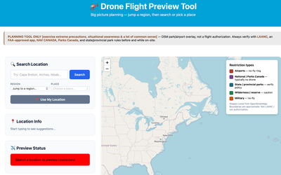
Wherever you go, part of the pre-flight process/workflow should always include an overview of the general area. Often when venturing into new places, even surrounding National Parks the assumption is you can't fly, yet,,,,,
Who Manages the Ground Around Moab?
Moab sits in a patchwork of public and private land. From a camera bag — or a drone bag — that patchwork matters as much as the light: who manages the ground shapes access, rules, and how a day outdoors actually unfolds.
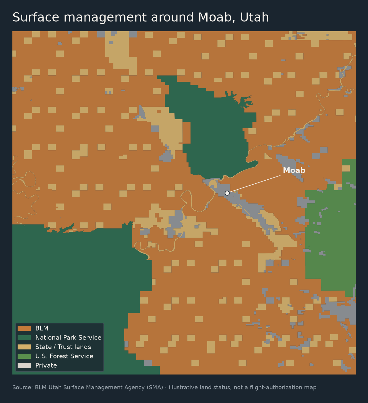
This is a first look at surface management around Moab using open data from the BLM Utah Surface Management Agency (SMA) layer — the same family of GIS many planners and recreation maps draw from.
What this is: an illustrative map of land managers in a Moab-area window.
What this is not: a flight-authorization map, a substitute for, LAANC, park rules, or a BLM field-office notice.
The big picture
In this map window, BLM land dominates — roughly three-quarters of the GIS acreage. National Park Service land (think Arches / Canyonlands country) is the next large block. State/trust lands show up as that familiar checkerboard. Forest Service and private parcels fill in the rest.
That matches the feeling on the ground: endless open desert under BLM, with park boundaries as hard edges and town/river corridors as a thinner private ribbon.
Acreage in this window
These numbers are GIS acres inside the map extent — useful for comparing categories, not a legal survey or county total.
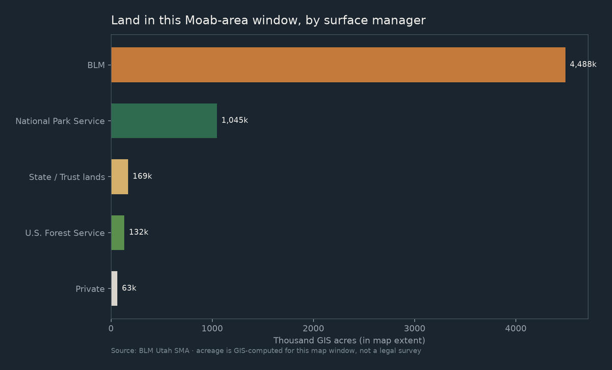
| Surface manager | Share of map-window acres (approx.) |
|---|---|
| BLM | ~76% |
| National Park Service | ~18% |
| State / Trust lands | ~3% |
| U.S. Forest Service | ~2% |
| Private | ~1% |
Why photographers (and pilots) should care
- BLM — often the open desert you drive and hike; still has local rules, closures, and recreation designations
- NPS — Arches / Canyonlands-scale protection; drone and access rules are their own world
- State / trust — the checkerboard; different permissions than neighboring BLM
- Private — concentrated near town and corridors; not “public just because it’s empty-looking”
Land status answers who manages the dirt. Airspace, TFRs, and park superintendents answer whether you can fly. Keep those questions separate.
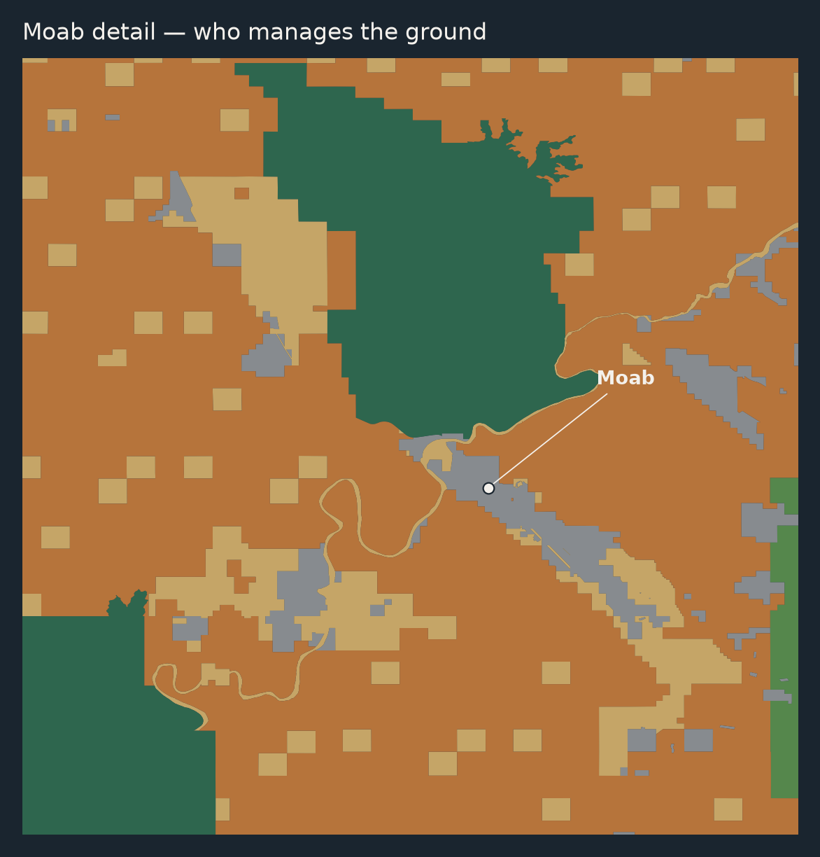
A tighter look at Moab
How this was made (short)
- Queried BLM Utah SMA for a Moab-area bounding box
- Grouped parcels by surface manager (
ADMIN/ legend fields) - Mapped and charted with Python (
geopandas+matplotlib)
Bottom line
Around Moab, the story on the map is mostly BLM orange, with park green as the big counterweight and a state checkerboard woven through. It’s a clean first experiment in putting open land data on the site — geography you can feel when you’re out there with a camera of any type. Utah is unique, especially the Moab area. It's a stark contrast to other areas I've photographed across the country.